Parcel Data Aggregation for Leading Data Aggregator Led to High Performing Database

Data Aggregration Apr 20th, 2024

The Objective:

The client a leading real estate parcel data aggregation company empowering its global clientele with real estate data and insights.

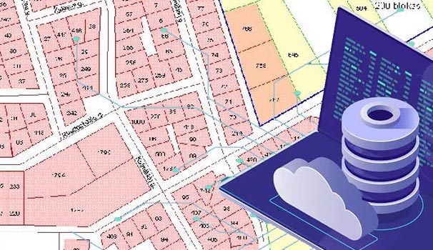
They were looking to partner with a data management company who could capture 650,000+ records every month from disparate data sources and input it in a structured manner.

The client looked to replace manual, time consuming process with automated process leading to enhanced accuracy and speed.

The Challenges:

  • Processing huge volumes of unstructured data
  • Getting on board resources with strong analytical skills and domain knowledge
  • Managing 225 full time skilled resources deployed for this project
  • Implementing tools and technology to improve accuracy and enhance speed
  • Putting up real time data from multiple online sources
  • Capturing, verifying, validating and integrating data from disparate real estate sources

HabileData’s Solution

  • A seamless workflow was planned for entering data from property documents.
    • The process was automated and semiautomated with custom logic and macros, saving time on predictable and repetitive tasks.
    • Data was captured from images and other disparate sources both structured and unstructured.
    • Data was further classified, standardized, validated, integrated and entered in structured manner.
    • Resources with high level of analytical and comprehension skills and eye for detail along with pre-defined 80 logical rules and 52 micros created internally ensured following deliverables:
      • More than 650,000+ records processed monthly
      • 98% accuracy
  • The workflow was broken into modules and resource allocated as per the expertise of the team member.
  • Classification and tagging:
    • Client uploaded the images on the FTP server.
    • The images were classified and routed through custom macros to different folders based on their counties; macro ensures 100% accuracy in county-wise data segregation.
    • Folders were auto created; custom macros ensure that only the valid images move to the assigned folder.
    • Valid documents taken for data entry in the specified fields.
    • Real estate data was scraped from multiple real estate sites and collected from property document images as well.
    • Scheduled web crawlers paced up online data capture process.
    • Parcel data was validated and mapped against GIS mapping, location tracking details, and data from other real estate multi listing sites.
    • New property information was added with help of programmable bots.
  • The data to be entered was categorized into three sections – Yellow entry, Double D entry and Gray entry.
    • Double D Entry – These are the extremely critical fields where two teams entered the same data and the files were verified and merged using macros.
    • Gray Entry – The lesser critical fields such as buyer info and property data etc.
    • Yellow Entry – Complex data fields requiring significant comprehension skills and hence addressed by specialized teams.
    • All the three fields (Gray, Double D and Yellow) are merged using in house developed macros.
  • Quality check and audit
    • Automated quality check through predefined rules ensured accuracy.
    • Additional audits were done before submission.
  • Submission
    • The files submitted into the client interface/application.
    • Append property parcel data on client’s portal through API credentials.
    • Reports/dashboards at granular level were shared with client.

Business Impact

  • Updated and comprehensive property data pool
  • Enhanced customer experience and engagement
  • Improved operational efficiency

Value Addition

Automated parcel data aggregation helped the leading MLS put-up real-time data from multiple online sources on their portal assisting customers with relevant information and connect with real estate professionals.

Go to Top